1860 rail map of Vermont
Shared by Ian West on Critical Omissions.
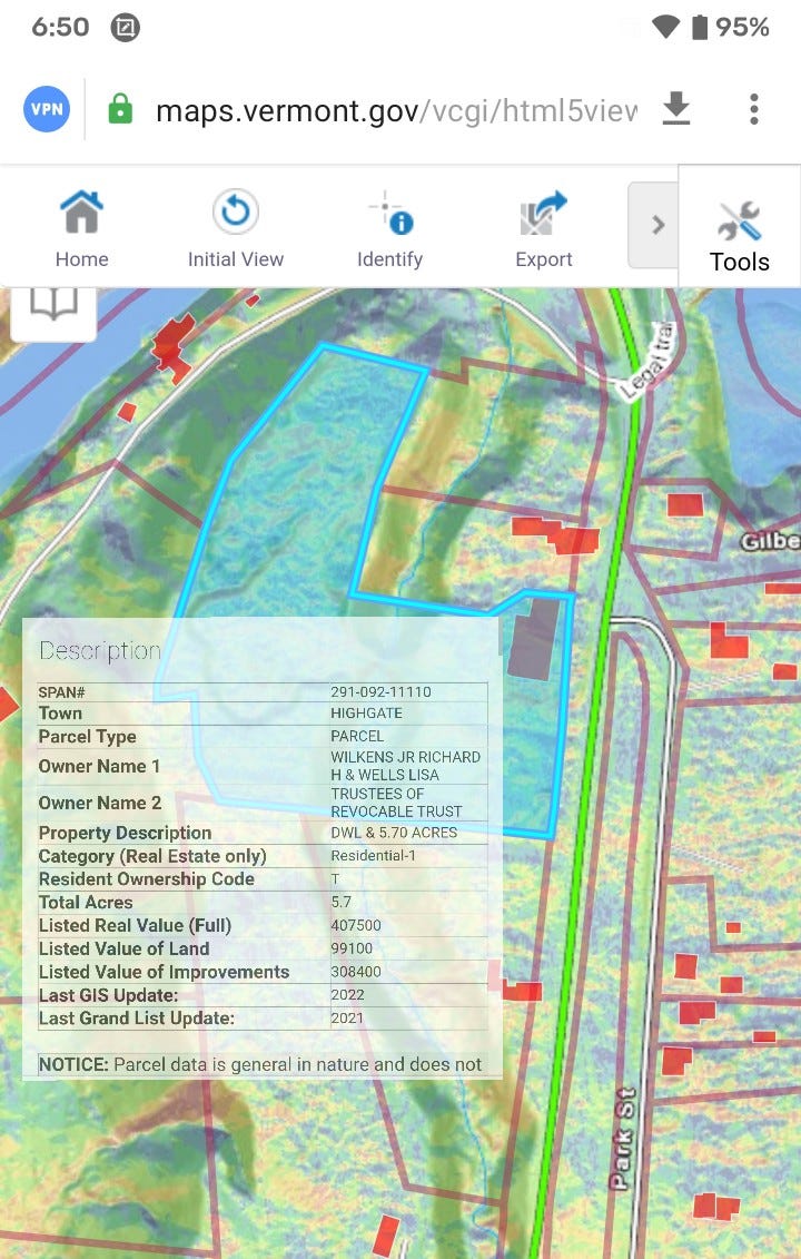
This map art is focused on the small community along the northern forest canoe trail. The parcel neighbors a property which has been occupied by the same family more than four centuries. Learn more about the sale,
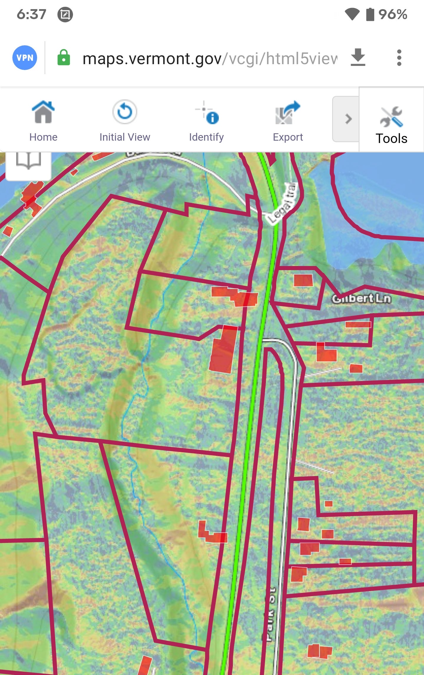
Location maps
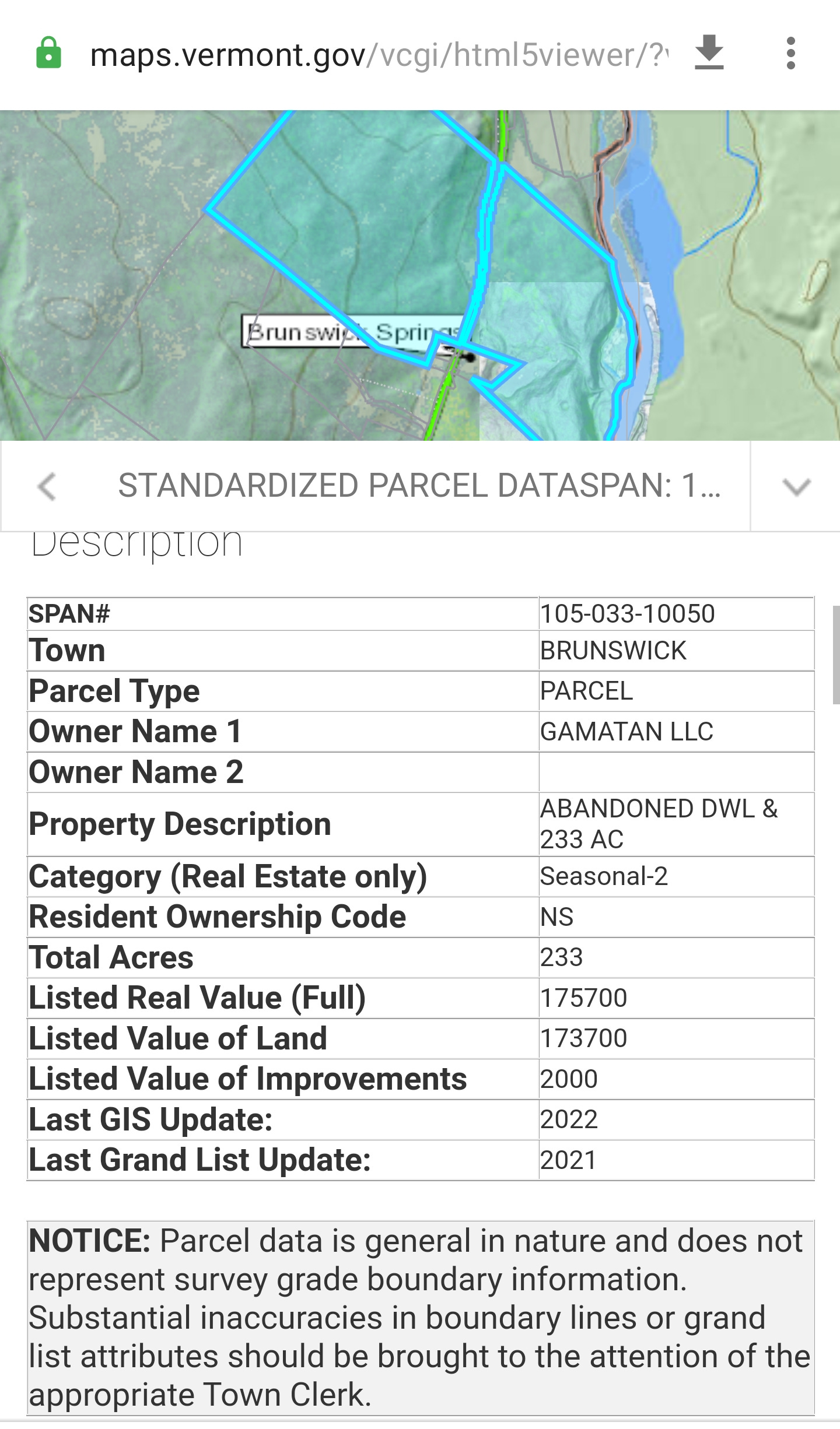
Notice the Manor parcel crosses the water, brook. It has a circle structure opposite the Brook.
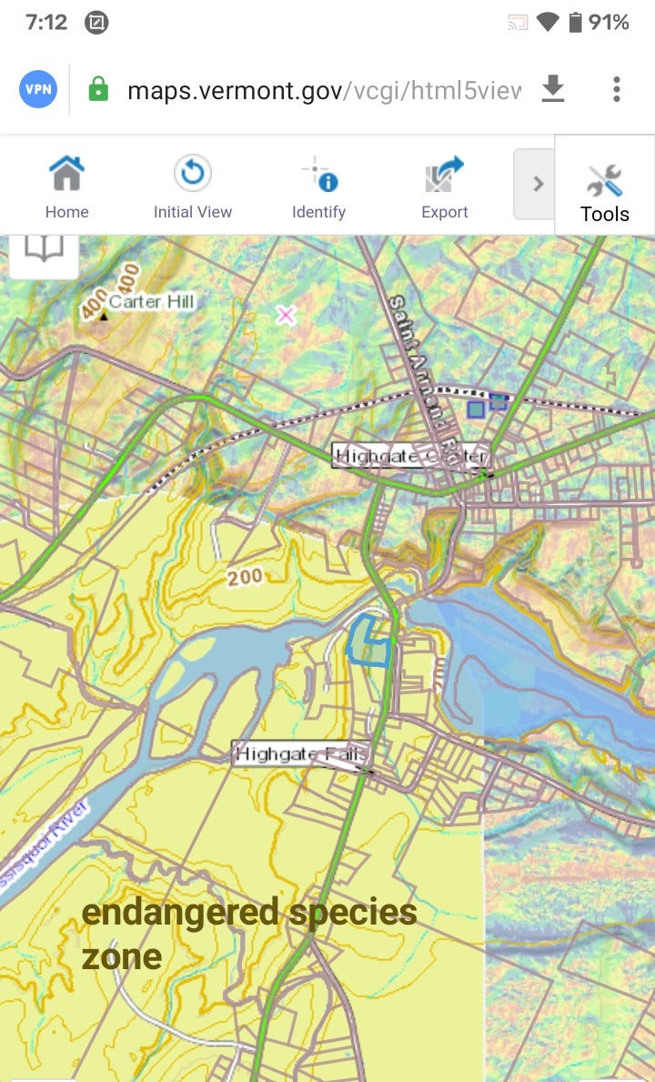
The 1860 map connects a bit through Highgate, VT to line in St. Albans.
What about the tunnel? It could be relative to the park square, or near the churches. Easily could be down the river as well.
Still searching archeology, my goal is to collaborate with other people. In this link, there are guides to survey GIS.
(@markwalters)
https://drive.google.com/file/d/1jiVT1Lk10Uz6ispGl2jidI3eKCuj4oUy/view?usp=sharinghttps://drive.google.com/file/d/1jiVT1Lk10Uz6ispGl2jidI3eKCuj4oUy/view?usp=sharinghttps://drive.google.com/file/d/1jiVT1Lk10Uz6ispGl2jidI3eKCuj4oUy/view?usp=sharing
A lot of people have asked me how to do this, so here is a quick pdf guide download on how to create #3D #lidar models in #QGIS with visualisation layers & other overlays. It is based on the Welsh lidar data, but can be used for other UK lidar data too & assumes very basic #GIS & QGIS skills
https://mastodon.online/@markwalters/109376173223278055
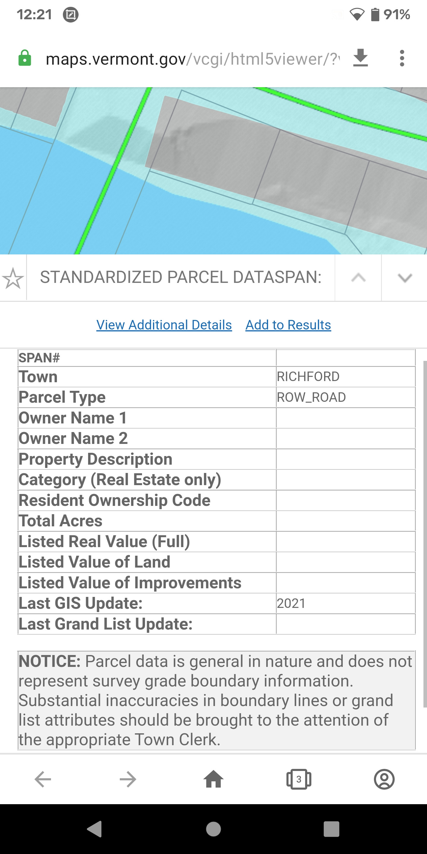
Richford, VT
River Row: watershed infrastructure
Riverside natural structure, intersection of mandmade bridge/supplies rampart. Also connects to Morristown line in map from pre civil war.